By
Joel Robinson
May 8, 2026
•
3
min read

Property research has always been time-intensive. Developers and their teams have traditionally had to move between council portals, state planning systems, aerial imagery providers and title search tools just to assemble the basics on a single site. It's a workflow problem dressed up as a research problem, and it compounds quickly across a portfolio.
Landchecker is built around a simple proposition: put all of that in one place.
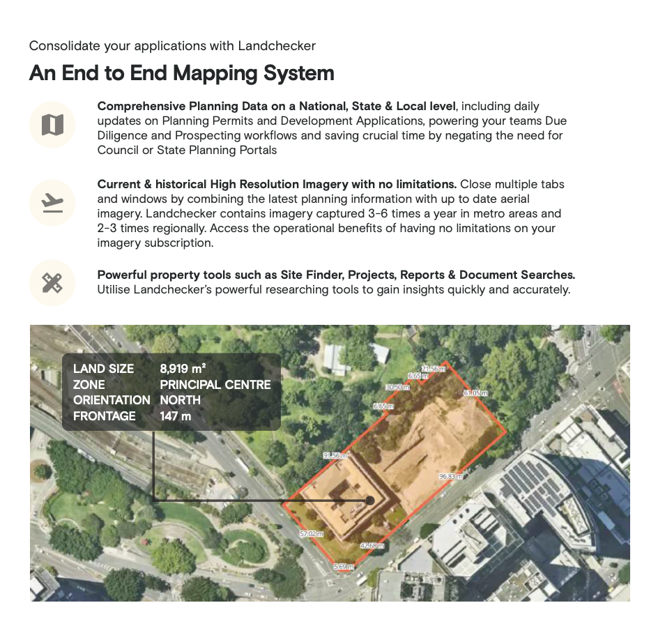
At its core, Landchecker is an end-to-end mapping and property data system that consolidates the information development teams rely on most. Planning data is updated daily at a national, state and local level, covering permit activity and development applications sourced directly from more than 400 local councils. For teams running due diligence or prospecting workflows, that means no more switching between council portals or state planning portals to check what's happening on or around a site.
Aerial and high-resolution imagery is built into the same interface, updated three to six times a year in metro areas and two to three times regionally. The practical effect is that current site conditions, nearby development activity and land use context are all visible without opening a second application.
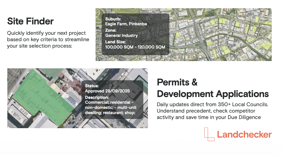
The platform also includes a Site Finder tool that allows users to filter potential sites by suburb, zone, land size range and other criteria. For developers actively building a pipeline, it streamlines the identification process considerably rather than relying on manual searches or third-party prospecting tools.
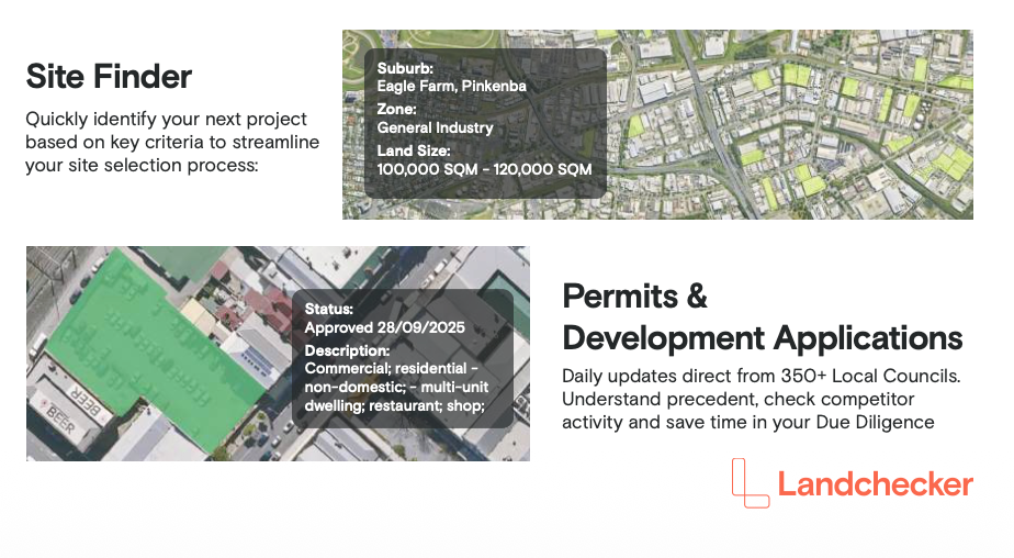
Where Landchecker creates genuine operational value is in the due diligence phase. Understanding the permit history of a site, checking what's been approved in the immediate area, and assessing zone and frontage details are tasks that would previously require multiple portals, phone calls and waiting on council responses.
With daily updates from councils across Australia, the platform gives teams a live view of application status and precedent decisions, which matters when you're trying to move quickly on an acquisition or building a case for a project's feasibility.
The site detail overlay, which surfaces land size, zone, orientation and frontage in a single view, removes a further layer of manual assembly that typically slows early-stage assessment.
Landchecker is used across the residential development sector by a range of businesses including agencies, development managers and project marketers. Its value is consistent regardless of team size: less time navigating government portals means more time on analysis and decisions.
For developers managing multiple active projects alongside a live acquisition pipeline, that efficiency gain is compounded. The platform replaces a set of disconnected tools and habits with a single workflow, and the daily data refresh means teams aren't making decisions on stale information.
Landchecker offers a free two-week trial for new users, making the platform straightforward to evaluate against existing research workflows before any commitment.

Landchecker is the exclusive research partner for the Apartments.com.au Market Insight Live event, providing data and analysis to support the Develop, Divest, Delay panel. The panel brings together a group of residential developers to examine how current market conditions are shaping project decisions, and Landchecker's planning and permit data will underpin the research that informs that conversation. For anyone working in the residential development sector, it's a timely demonstration of what access to consolidated, current property data can do for strategic decision-making.


Speak to the team about leveraging the Apartments.com.au audiences and services for your new development.

Greg Billings
Director of Residential Projects
Sonia Fava
Director
Nick Clydsdale
Senior Director
Heath Thompson
Director

Todd Matheson
Director
Thomas Panson
Project Sales & Marketing Agent
Scott Jessop
Head of Sales & Marketing

Alex Adams
Head of Sales & Marketing and
Head of New Business
.png)
.png)


.jpeg)

.png)
.png)
.jpg)


.png)

.png)


